Quantcast
Channel: The Mill Creek Hundred History Blog
Viewing all 332 articles
Browse latest View live

Kidnapped to Mill Creek Hundred -- The Amazing Tale of James Annesley

$
0
0
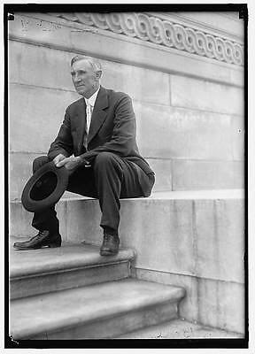
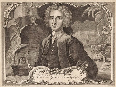
James Annesley, one-time MCH resident
This is a story that's been bouncing around for a while, one of those I just never had a chance to get to before. It's been brought to my attention several times -- by Walt Chiquoine a while back, more recently by commenter Sue V., and probably at least once before that. I think one of the reasons I've put it off is that I've been waiting to find that one piece of solid evidence that ties it to the familiar for us, but I've yet to come across it. At this point accepted that our best bet is to put it out there and let more people take a look.

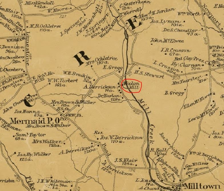
Many of you may be familiar with the 1886 Robert Louis Stevenson novel Kidnapped, which has been adapted for movies and television at least a dozen times over the past century. It's the story of a young Irish boy, recently orphaned, who discovers he's heir to an estate. Before he can take possession of the estate his evil uncle has him kidnapped to be sent off into servitude in the Americas. The boy escapes after his ship wrecks off the coast of Scotland, has a series of adventures across the Highlands, and eventually gets his inheritance back from his uncle. Stevenson's "boy's novel" has, over the years, become much beloved by readers everywhere.

As thrilling as the story is, what's really amazing is that it may well be inspired by a true story. In real life the boy, also an Irish orphan set to inherit an estate, did actually get sent to the Americas as an indentured servant by his uncle. The most intriguing part of it for us, though, is that the boy in question, James Annesley, spent many of his servile years right here in Mill Creek Hundred.

James Annesley was reportedly born April 15, 1715 (we'll have to remember to celebrate his 300th this time next year -- someone else can bring the candles) to Arthur Annesley 5th Baron Altham. The Annesly family history is rather complex, but the short version is that they were an English family that became prominent and wealthy in the 1600's in Ireland and the home isle. All looked good for them until the early 1700's, when due to numerous tragic deaths and other circumstances the family title passed out of the main line and to a ne'er-do-well younger cousin. This was James' father.

The young Arthur abandoned his wife, then reconciled long enough to produce James. Soon after he threw her out on false charges of adultery, then threw eight-year-old James out onto the streets. When Arthur died in 1727, his younger brother Richard moved in to take over the title and estate. If anything, "Uncle Dick" seems to have been a worse person than his brother. Seeing that young James (then called "Jemmy") could be an impediment to the inheritance, he had the boy kidnapped and sent to America.

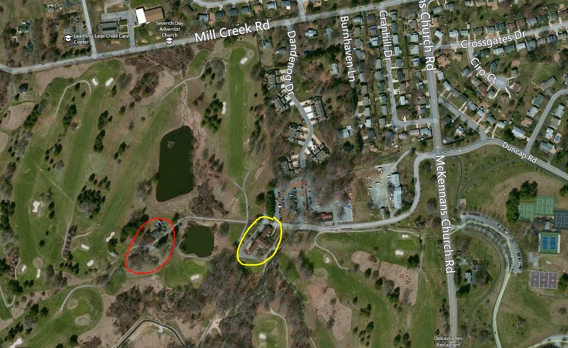
On April 30, 1728, Jemmy was abducted at Dublin's Ormond Market and stuffed onto a ship (ironically called the James) bound for what was then a thriving port -- New Castle. After arriving in New Castle, James was purchased by a small-time farmer and taken away. This is where it gets interesting for us, because his new master was Duncan Drummond of Mill Creek Hundred. Annesley spent 12 years essentially as a slave in America before returning home to fight for his rightful inheritance. Thanks to the transcripts of his court case (a sensation at the time) and a version of the tale published in a contemporary newspaper, we have a pretty full account of his time in the colonies.

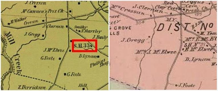
As mentioned, James' first master was Duncan Drummond. We know a little about Drummond, but not quite enough. Thanks to several sources (including Walt), we know that Drummond was close to the Robinson family of Milltown, and about this same time purchased around 110 acres from George Robinson. This tract extended eastward from Mill Creek, somewhere between Milltown and Stanton. The other question probably on everyone's mind I can't quite answer for sure -- was he related to Polly? My guess is that Duncan was likely an ancestor of Polly's husband James, maybe his grandfather or great-grandfather. As of yet, though, I haven't found the smoking gun that would prove it.

But getting back to the young James Annesley, it seems that Drummond was not a very good master. He beat James and generally treated him poorly. James reportedly retained his dignity throughout the ordeal, knowing his status and always believing that one day he'd return home to claim what was his. He probably saw himself as being "above" the other servants, and as a result mostly kept to himself. The one exception was an older female servant -- herself a victim of a kidnapping -- who had received a bit of schooling. James befriended her and she acted as his teacher, at least whenever Drummond wasn't looking.

James Annesley, c.1750

After about four years, though, James' friend died and he'd decided he'd had enough. He ran away, but fate was not to smile upon him yet. The whole story is recounted here, but the short version is that he fell in with some people who were going to help him, but it turned out they were accused thieves. The group was caught and taken to the jail in Chester. The others were condemned to death, but James was able to convince the judge of his innocence. He was still held, though, displayed every day in the marketplace to see if anyone had seen him in Chester before. After five weeks of this, Duncan Drummond happened to be in town on business, recognized his escaped slave, and took him home. As a result, two extra years were tacked on to the two that had been remaining on his servitude.

After returning home (where, exactly, I frustratingly don't know), Drummond's treatment of Annesley became even worse. James complained to the court in New Castle, and Drummond was forced to sell him to a new owner. Here lies another hole, as none of the accounts I've seen mention the new owner's name. Whoever it was James survived another three years with him, until a chance meeting with some sailors bound for Europe. With his ambitions thus spurred on, James attempted another escape, but this one was no more successful than the last, except that he was recaptured without a prison stop.

After returning again to captivity, James became so depressed that his master took pity on him and assigned him to his wife's care. This also happened to include the care of the master's daughter Maria, who soon fell in love with him. And she wasn't the only one. Another slave, an Iroquois girl named Turquois, also became quite smitten with him. Ok, maybe more than smitten. (Must have been the brooding and the accent. There's no competing with brooding and an accent.) It seems James politely rebuffed both girls, but the "Indian girl" didn't take it so well. One day she confronted and attacked Maria, then in a fit of anger, despair, and maybe remorse threw herself into the nearby river and drowned.

As you might expect, the master was not happy to have lost a servant and nearly a daughter, but after hearing everything out determined that James was innocent of any wrongdoing or inappropriate behavior. To keep the peace and appease his daughter, he promised to set James free. However, after taking him to Dover he instead sold the Irish young man to a planter near Chichester. After some time with this master, James was transferred to another owner "whose house was almost within sight of Drummond's plantation". With more research, we might even be able to determine where he might have been.
Annesley Hall, which I think was James'
ancestral home in England

Amazingly (or maybe not so amazingly, considering that much of this came from a magazine story), James' adventures were not over. Soon after arriving at his new home, he was tracked down by two brothers of Turquois, the spurned Iroquois maiden. They were looking for revenge from Annesley, but he managed to fight them off and narrowly escape. Soon after, he happened to overhear a plot between his mistress and a neighboring servant to rob his master and flee together to Europe.

Instead of going to his master, James confronted her and threatened to expose her if she didn't change her plans. She did (for the time being), and apparently tried to "win over" James. I don't think she was a very good wife. After failing in this, too, she tried to poison James, who survived only because a cat accidentally ate the tainted soup and died before his eyes. Having never abandoned his desire to return to Ireland, and even though his period of servitude was nearly up, he made one last attempt to escape.

This time, unlike the previous attempts, the now 25 year old Annesley was successful in gaining his freedom. He boarded a merchant ship to Jamaica, where he made his way onto a British warship which returned him to Ireland. He set about regaining his birthright, which he did after what was at the time one of the longest trials ever seen in Ireland (15 days). Of course, on par for the story, this was only after successfully defending himself from a murder charge after killing a man in a hunting accident.

I apologize for the length of this post, but you really have to hear the whole story to fully appreciate it. For many years much of James' story was dismissed by historians as fiction, a tale exaggerated for the reading audience at the time. Recently, though, the work of history professor A. Roger Ekirch shows that there is far more truth to it than previously assumed. Could some of Annesley's colonial adventures be a bit padded? Sure, but many of the basic facts seem to hold up, and to me it's fascinating that much of the story took place here in Mill Creek Hundred. If we're ever able to more closely pin down some of the locations, I'll be sure to pass them along.

Mid-Week Historical Newsbreak -- McKennan-Klair House Sales Ad

$
0
0
So the other day I was looking through one of the collections of newspaper articles that Donna Peters had sent me a while back, trying to come up with something good to post this week. One in particular caught my eye, and after taking a closer look and checking a few things out I got very excited by what I found.

The ad, seen on the right, came from the July 26, 1764 edition of Philadelphia's Pennsylvania Gazette. At first glance it looks like a pretty typical ad from the time for a property sale, this one being in Mill Creek Hundred. The wording of the ad makes it clear that it's an estate sale, and goes on to give a good description of the property, the structures present on it, and some of the other personal property to be sold at the same vendue, or public auction.

There are several interesting things in the ad, besides the fact that "a thriving Negroe Girl, 12 Years of Age" is very matter-of-factly listed along with other pieces of property to be sold. The tract is noted to be along Mill Creek, with "the great Road leading from Newport to Lancaster" running through it. Being situated on the road, the ad states that the house "will suit either Store or Tavern-keeping". What really caught my eye, though, having just completed the James Annesley post, was the mention of the name Robinson. As you may recall, Annesley spent several years on the farm that Duncan Drummond had just purchased from George Robinson. Whether it was connected at all to that story or not, I had hopes of determining exactly which property this might have been referring to, as I did back with the Merestone ad last month.

The more I read it, the more some of the names started to sound familiar. With the mention of Mill Creek nearby, I figured that the "great Road" noted in the ad was probably Limestone Road. The only place that Limestone Road comes near Mill Creek (and where it crosses it) is in the Milltown area. That fit perfectly with the names in the ad, especially Robinson, Ball and even Springer. At this point I had a hunch, so I went to check it out.

The McKennan-Klair House

I went back and found the post from over 3-1/2 years ago on the McKennan-Klair House, which stands on the east (actually at that point, north) side of Limestone Road just above Milltown. Although I had skipped quickly over the earliest years of the house in the post, sure enough the owner previous to Rev. William McKennan was John Robinson. I even had to remind myself that yes, the oldest part of the house (the part that would have been present in 1764), even though it's now covered in stucco, is actually brick, as the ad states.


What really clinched the connection was when I looked at the deed summary (above) of the property that was included in an old DelDOT report. As you can see, the reason I had originally glossed over this is that, frankly, it's what's technically known as "a big ol' mess". Most of the the details of the early history of the property are still not relevant to us now, but the important points are that: A) it ended up with John Robinson, B) he died in 1764 leaving the house to his heirs, and C) McKennan's purchase of the property was finalized in 1765. Whether the good Reverend didn't purchase it until 1765 or whether he bought it at the August 1764 sale and it wasn't recorded until the following year, I don't know.

Whatever the details of the eventual sale were, it seems pretty convincing that this ad is, indeed, referring to the McKennan-Klair House. Maybe I just get excited easily, but I think it's really neat when one of these old ads can be linked to a specific property, especially when it's for a house that's still with us.

The Newport-Gap Road That Never Was

$
0
0
Page 1 of the 1804 Road Survey
As noted in several previous posts, the first few decades of the 19th Century were busy time of road building in the early Republic. The tumultuous years of the fight for independence and the somewhat chaotic period of sorting out the new country and its war-ravaged finances was drawing to a close. The country was growing, and so was its economy. With more people and merchandise on the move, everyone realized that the existing road system at the time was inadequate for the new nation. New thoroughfares needed to be constructed, whether by blazing new trails or improving old roads, many of which were no more than mildly glorified cow paths.

Then, as now, there were two different ways to go about funding something as ambitious as building a new road -- publicly or privately. In New Castle County, the task of publicly funding things like roads and bridges was given to the Levy Court. The newly-developed method of private funding for roads was the turnpike company, a corporation licensed by the state to build a road and allowed to collect tolls to pay for the maintenance of the road. As we've seen, the way history played out the Gap and Newport Turnpike Company was incorporated in 1808 in the State of Delaware, to extend southward a planned road leading from Gap, PA to the DE-PA state line. This is what we now call (in Delaware) Newport Gap Pike.

However, 210 years ago there was another plan floating around, prior to the forming of the turnpike company. And while it's obviously important to know what actually occurred in the past, it's also fun to think about the what ifs. The could have beens. The almosts. And to try to think how this alternate history would have differed from our own. In this case we're contemplating a road that never was, and thanks to the work of Walt Chiquoine, we can see exactly where this road would have been.

In 1804, in response to petitions for road improvements, the county authorized a survey to be taken for a new public road from Newport to the state line near Hockessin. It should be noted that this was not Newport Gap Pike (NGP), but predated it by several years. The path of the proposed road was generally similar to NGP, staying within about a half mile of the road we know today, but with several major differences. You can see from the image at the top of the post what Walt had to work with to map this thing out. There are two more equally thrilling pages that follow. Below is his map of the proposed road, and underneath that is a description of it in Walt's own words.

Proposed Public Road, 1804
 

The "Public Road" followed Wilmington Road from the state line to (now) Valley Road, then proposed a nearly straight path to Loveville Road (Robert Montgomery's tavern). It went down Loveville/McKennan's Church road to the current intersection with the Gap Newport Pike (the Priest's Gate), but then cut directly southeast to intersect with Duncan Road just below the house of Ephraim Yarnall, deceased.

As you can see, there are several interesting differences to note between this projected roadway and the one ultimately constructed about a decade later. First (going south to north), instead of heading straight out of Newport, the Public Road would have utilized existing roads for its southern portion. More importantly, it would have utilized Hersey's Bridge over Red Clay Creek, already in place in what would become Marshallton. It then followed what was the main road in the area, today's Duncan Road. This fits perfectly with what Walt told us in his earlier post, "Duncan Road: A Colonial Highway". We'll get to the red part in a moment.

The survey then has the road continue straight, veering from Duncan Road about where Faulkland Road meets it now. It continued straight until it met McKennans Church/Loveville Road, pretty much exactly where NGP intersects it today. The road then followed Loveville Road until its terminus at Old Wilmington Road, then shot in a straight line towards the northwest. It rejoined Old Wilmington Road at Valley Road, then followed Old Wilmington to the state line.

Section centering on the Faulkland Road/Duncan Road intersection
Now for the red section, shown in greater detail above. The reason Walt blew this part up is that it's sort of the reason I brought it to his attention in the first place. I came across a mention of the 1804 survey in a DelDOT report on a section of NGP while researching the Justis-Jones House. In a footnote discussing the survey (page 17), noting that the plot has the road passing to the east of the Yarnall House, the report concludes that the Yarnall Tavern originally faced to opposite direction -- east instead of west. I thought this was very interesting for several reasons (not the least of which is that it would place the construction of the tavern prior to 1804), so I forwarded it to Walt for his opinion.

Unfortunately for that story, the report writer was working under several erroneous assumptions. First, the 1804 survey was not for the Gap and Newport Turnpike, but for a possible public road. Second, the road plot did not, as we can see, completely follow existing roads, so there never was an old road east of the Yarnall House that it originally faced. The proposed road would have essentially cut through their backyard. Third, Yarnall House mentioned was not Holton Yarnall's Conestoga Wagon tavern, but was in fact the older home of his father, Ephraim Yarnall. This house sat on the southeast corner of Duncan Road and Faulkland Road, as shown in the diagram above. So much for the wrongway facing tavern.

But back to the road that never was. For the most part, had this road been built instead of the Newport Gap Pike we know today, things probably wouldn't have been a whole lot different. Two things do stand out to me, though. For one, it would have meant that this major roadway would have gone straight through the middle of what would become Marshallton. What effect would that have had on the always relatively small village? Would it have grow larger?

At the other end, the Public Road, following Old Wilmington Road, would have passed east of what became "downtown" Hockessin, which was centered around Lancaster Pike (as NGP is label up there). Would Hockessin still have grown where it is? Would it be centered along Old Wilmington Road, maybe near the Friends Meeting House? I don't know, but sometimes playing with alternate history can be fun -- even when it's just The Road That Never Was.

The Wells-Gregg Farm, AKA The Delcastle Farm

$
0
0
Date stone in the ruins of the Delcastle barn
Several years ago I did a post about the Delcastle Farm, the farm manned by prisoners from the New Castle County Workhouse at Greenbank. It was located along McKennans Church Road on the site which has been home to the Delcastle Golf Course since soon after the farm's closing a little more than 40 years ago. Although I'd wager most people (aside from readers of this blog, of course) are unaware of the history there, signs of the past still abound at the site. Several of the buildings, including the clubhouse and barn, date back to the prison farm era. However, the history of the property (of course) didn't begin with the county's purchase of it about 1915.

In addition to the workhouse farm era buildings, there are a number of other structures dotting the golf course that date to an earlier, and in some cases much earlier, time. I had been aware of some of these for a while (thanks to Mark Julian a few years back), and I've always been interested in the earlier history of the property. Recently, though, I was emailed by Buddy Williamson, who is also curious about the subject, and he even turned me on to a few things I didn't know before. He asked if I knew any more about the older history of the farm and sent me the photo above. Well, funny story.

When he wrote to me, I really didn't know much about the pre-20th Century history of the property. I did some quick research, came up with very little, and even started writing a good bit of a post about it. It was going to be one of those, "I don't know as much as I'd like, here's what I got, I hope someone can come up with some more" kind of posts. Then, one afternoon (after having already written most of the post, mind you), I came across some missing links that made everything fall into place. Now I can confidently say that I know most of the history of this property.


Gregg House and barn (red) and golf course clubhouse (yellow)
The property that encompasses most (or all) of the current golf course and former prison farm seems to have been centered around a house (which is still standing) and barn (which is mostly not standing) located just behind the present-day golf course's clubhouse. In the aerial shot above, the clubhouse is circled in yellow and the house and barn in red. Stay with me on this, but we're going to sort of start in the middle of the story, work forward, then go back toward the beginning.

Sometime around 1800 (probably a couple years after), the farm was purchased by a man named Benjamin Gregg (1771-1835). He was a member of the Gregg family that originally settled in Brandywine Hundred, and his great-grandfather John is thought to have built Strand Millas and possibly Rock Spring. Benjamin and his wife Mary raised ten children on their farm, and both spent the rest of their lives there. The Greggs being Quakers, Benjamin and Mary were both buried at the Hockessin Meeting House. After Benjamin's death, the farm passed to his eldest son, John Gregg (1809-1877). It is John who is the "J. Gregg" shown on both the 1849 and 1868 maps.

John Gregg on the 1849 (left) and 1868 (right) maps

John resided his entire life on the family farm, along with his wife Sarah Ann (Walker). After John's passing in 1877, the farm was purchased by his son Benjamin (1835-1910). Benjamin Gregg, along wife his wife Elizabeth (Woodward) Gregg, continued for several decades to farm the land on which men now drive and putt. As he got older, though, he turned over operation of the family farm to his son, Joseph Morton Gregg (1868-1933).

Joseph (or Morton, or J. Morton, depending on the document) probably grew up working the farm with his father, and continued to farm into the early 1900's. The 1900 Census still has him listed as a farmer at what must be the farm. For whatever reason, however, J. Morton Gregg did not remain a farmer much longer. In the 1910 Census, he's listed in Faulkland as a miller at a flour mill. My assumption is that this means he operated the Fell's old grist mill along the Red Clay, close to where the spice mill once stood (and where the burned out remains of it probably still stood then). It is possible, though, that he worked at Greenbank instead.

So J. Morton was not living on the family farm by 1910, but exactly who was is one of the few remaining holes in the story. New Castle County seems to have purchased the property about 1915, but I've yet to see from whom. Joseph Morton Gregg might have sold the farm to someone else after his father Benjamin's death in 1910, or he might have held it and sold directly to the county. In either case it passed out of the Gregg family for the first time in over a century. Now to go back and see how it entered the family.

Close-up of the Delcastle barn date stone

I had known that the Greggs owned the property for most if not all of the 1800's, but that didn't help with the barn's 1793 date stone, seen in close-up above. From the layout of the initials (H over top H&W), you'd think we'd be looking for someone with a last name starting with H, and first names with H and W. I asked around and looked through the 1800 Census and 1804 tax list for anything that fit, but nothing jumped out at me. Then I ran across this page and the following paragraph about a quarter of the way down:
Benjamin Gregg is a farmer and owns the same farm that was the home of his Grandmother Gregg, who was Mary Wells, a daughter of Harrison and Hannah Wells, and was born 12, 26. 1787. She married Benjamin Gregg, who purchased this farm, and which was their home with their ten children until their death. Benjamin died 2, 13, 1835, Mary died 5, 31, 1869. Their eldest son. John, who married Sarah A. Walker (1834), purchased the farm and it was the home of their four children. After the marriage of their eldest son Benjamin it became his home, and continues to be at this time (1898). although his youngest son, J. Morton Gregg, attends to the farming.
Not only did that clear up most of the Gregg's tenure (which I knew most of), but more importantly it provides the previous owner and the link to the Greggs! Benjamin Gregg bought the farm from his father-in-law Harrison Wells, or possibly from mother-in-law Hannah after Harrison's death in 1795. So the initials in the stone are those of H(arrison) & H(annah) W(ells), and Harrison has his own story.

Harrison Wells (1749-1795), sometimes spelled Wills, was born to Noah and Mary (Harrison) Wills, probably in Trenton Township, New Jersey. He married Hannah Van Leer about 1776, and not long after found himself in trouble...quite a bit of it. It seems that with the outbreak of the Revolutionary War, Harrison was convinced (at least that's how it was spun later) to become a Loyalist and side with the British against the Americans. After the British withdrawal from the area in 1778, local Loyalists were arrested and tried for treason, Wells among them.

Sometime later in the year, Wells was convicted of treason and sentenced to death. However, an appeal was made on his behalf and his sentence was reduced to a forfeiture of his property. It's logical to assume that it was after these events that he and Hannah moved to Chester County, in the area of Marple Township and Springfield. In 1786, they purchased from William Williamson the property that would one day become Delcastle. This page has a good bit of information about Wells, including the indenture (mortgage) for the 1786 sale.

There are still a few details yet to be filled in for the pre-prison farm history of the property, including who sold it to the county, a few small holes prior to Wells' ownership (although Walt Chiquoine has it pretty well laid out), and the exact construction date for the house that stands near the ruins of the stone barn. But, I've got to say, this is much more than we (or just about anyone else, as far as I can see) knew about it before. If anything more is uncovered, I'll be sure to pass it on.

The Delcastle Water Troughs

$
0
0
In the last post about the early history of the Delcastle Golf Course property, I mentioned that in addition to the few historic sites there I was aware of, Buddy Williamson had also brought up a few things I had not known about before. One of the most interesting is the existence of five stone water troughs, like the one seen here. Each one has a different year carved into it. The years are 1902, 1903, 1905, and 1912.

To the best of our knowledge, no one knows anything about these troughs, who made them, or why. The significance of the dates is a mystery. By my thinking, there are three possibilities for who made the troughs. If they were placed in or near the years carved on them, then the most likely suspects would be the Greggs, assuming they still owned the farm. If they did sell it in the interim between 1900 and 1915, then whoever that owner was could have made them. Finally, if the troughs were placed after the fact, and the dates commemorated something in the past, then the county could have commissioned them during the workhouse farm era.

Right now, what the dates mean is anyone's guess. Thinking that Joseph Morton Gregg could have made them (and being a parent myself), my first thought was to look at his children. He did have four, but matching them up with the dates puts them at ages 8, 6, 6, and 8. Perhaps the years commemorated something else important in their lives?

If the county is responsible for them and they were placed sometime after 1915, then the assumption is that the dates have some sort of meaning related to the Workhouse at Greenbank, of which Delcastle was a part. The Workhouse itself was opened in 1901-- close, but not quite. Maybe the dates mean something to someone who knows more about it than I.

The bottom line is that these troughs have been around for a while (Mark Julian remembers them being there in the sixties), and there's every reason to think they date from the years listed, or shortly thereafter. If anyone knows anything about these, please speak up. If anyone has any other theories that could be looked into, I'm up for that, too.

The Knowles Family

$
0
0
Harry Knowles, brother of Cpt. Thomas Knowles
Aside from researching and writing these posts, there are a few little projects I've always wanted to do but have never had the time to get to. One of them was to go through the censuses (1850 and later) and look for odd and unusual occupations. Maybe even try to calculate how many people were engaged in something other than farming or mill/factory work. There will be a fair number of expected "others", things like carpenters, doctors, teachers, cobblers, coopers and the like. I also assume that there will be a few that I either have to look up or that will take me completely by surprise. This is the story of one of the later. Would you be surprised to know that in 1880, in Mill Creek Hundred, there lived a lighthouse keeper?

There was, and his name was William H. C. Knowles. He came from a family of sea men and probably only lived in MCH for a few years, but his family has an interesting story. I was turned on to the Knowles family a few weeks back by an email from a descendant of the family, Cindy Cunningham. She knew a little about this part of the family, and I did some research and came up with a little more. Our hope is that someday someone with even more information about the Knowles family will help fill in some of the gaps.

The patriarch of this branch of the Knowles clan was Captain Thomas F. Knowles, born about 1814, most likely in Sussex County, Delaware. Although I don't know his exact lineage, the Knowles family had resided in Sussex County for several generations.  Cpt. Knowles supposedly owned a fleet of ships, which he operated worldwide. I haven't found anything to corroborate the extent of his sea-going empire, but he certainly was a ship captain. There are several references to his being a captain, and the ad below (taken from the New York Evening Post from September 1858) may very well be for one of his ships.


Thomas Knowles was far from the only seaman in his family. In fact, it seems that just about all the men in his immediate family spent their professional lives on or near the water. The photo at the top of the page is of Harry Knowles, Thomas' brother. The family story has it that he was a lighthouse keeper somewhere near Wilmington. This seems to be confirmed by the fact that, as far as I can tell from the picture, it is a US Lighthouse Service uniform that he's wearing. Although I don't know of any concrete evidence yet confirming exactly what Harry Knowles did or where he did it, the same can't be said of his niece and nephews. Thomas and his wife Sarah had at least three children, and we know at least a little bit about each one.

 
The one daughter, Sara Elizabeth (or Lizzie), eventually moved and married in Illinois. She is Cindy's great-great-grandmother. We know little about two of Lizzie's brothers, and most of what we do know comes from a couple of newspaper clippings that Cindy unearthed. One of the brothers was Frank (possibly Thomas Frank) Knowles, who followed in his father's soggy footsteps to sea. The clipping above tells all we know of him, but I'd just love to know the whole story. It's not every day that a man who "was long since supposed to be dead" turns up years later as a ship captain in Australia! And with a wife of eight years and a family, no less. The story, incidentally, comes from the Lewes, DE paper the Breakwater Light. This publication was founded and owned by Horace Greely Knowles, who must have been related. (And predestined by his name to the newspaper business.)


Another of Thomas' sons was George Knowles, and his fate was not as kind as his brother's. Like the others in his family, George made his living on the water. In his case, it was with the Revenue Service, or Revenue Marine, a forerunner of the US Coast Guard. According to the article and death notice seen above, he contracted consumption (tuberculosis) while serving on the Great Lakes. He returned to his father's home in Seaford in November 1871 to recover, but died the following March. He was 26 years old.

The final son of Cpt. Thomas Knowles was William H. C. Knowles (1845-1913), and it is with him that we have our connection to Mill Creek Hundred. Like his Uncle Harry, William was a lighthouse keeper. He married Lovey Spicer about 1870, and may have entered the U.S. Lighthouse Service around the same time. Unlike his Uncle Harry, I have found records of William's service that cover over 35 years and three different locations. His first job as a head keeper was at the Ship John Shoal Lighthouse, located at the mouth of the Delaware Bay, about due east of Smyrna. He served there for seven years, from 1875 to 1882.


Ship John Shoal Lighthouse today
It's during this time that the Knowles family resided in MCH, as reflected in the 1880 Census. Judging by the adjacent names, they probably lived on Old Wilmington Road near Loveville. The two families listed directly after them are those of James Springer and Martha Hulett. As a lighthouse keeper, William would have spent much of his time at the light and away from his family. A later account from the Ship John Shoal Lighthouse states that the men had 22 days at the light and 8 days ashore. Father Thomas and mother Sarah are listed with the family in the 1880 Census, Thomas being listed as a farmer. My guess is that they had a small farm run by Thomas, with William helping when he was "off" of his main job.

The family most likely moved only two years after the census, as William's next assignment took him back to Sussex County. From 1882 to 1890, he was the Head Keeper at the Delaware Breakwater Rear Range Lighthouse, just above Lewes. There was a keeper's house at the site, where the family would have lived (and may have known my family, who were living in Lewes at the time).

After his eight year stint there, William was moved back to New Castle County in 1890, when he was assigned to the Cherry Island Front Range Lighthouse. This light was located along the Delaware River north of Wilmington, on property now part of Dupont's Edemoor Plant. In fact, the road going north from Edemoor Road to Fox Point State Park is still called Lighthouse Road. This light also had a keeper's house (since demolished, like at the Breakwater light) where William and his family would have lived. This assignment seems to have been the last one for the one-time MCH resident, as William Knowles died in 1913. He, like several other of his family members, was buried at Riverview Cemetery in Wilmington.

As you can see, the history of the seagoing Knowles family only intersected with MCH for a brief time. But for that time -- and it might have been as long as seven or eight years -- there was actually a lighthouse keeper living in our hundred. The family's story is certainly an interesting one, and one about which (hopefully) more will someday be known.

Mid-Week Historical Newsbreak -- Another Mill Bites the Dust

$
0
0
(Philadelphia) Times - August 16, 1891
I haven't gotten to one of these newsbreaks in a while, so here's a quick little story. It comes to us from The Times of Philadelphia, dated August 16, 1891. It tells of the fire that destroyed Joseph Derrickson's woolen mill, reportedly near Stanton. As best as I can determine by looking at the maps, this is referring to the former Spring Grove Mill located on Mill Creek just below Stoney Batter Road.

The 1881 and 1893 maps both label the mill as "A. Derrickson", presumably for Aquila. This is slightly problematic in that Aquila Derickson passed away in November 1881. The Joseph mentioned in the article was Aquila's eldest son, who it seems acquired the mill after his father's death. I think the 1893 mapmakers may have leaned heavily on the 1881 version, since I recall seeing other instances where the later map seemed like it was not updated.

The Derickson Mill in 1881

For a while now I've wanted to write a post about this mill, but I've been unable to come up with much of what you'd call "facts", or "actual information". The closest I've come recently was discovering that Samuel Broadbent, the son of the former mill owner James Broadbent, seems to have built the Marshallton home of our new blog friend Craig. Beyond that it gets a bit thin.

I'm still hopeful that someday I'll stumble upon...um, I mean gallantly discover, more about this mill. If nothing else this article gives us an idea of the state of the mill in the early 1890's. My hunch is that it had already been shut down for good and was never rebuilt. If more comes up, I'll be sure to pass it along.

Catching Up and Some Odds and Ends

$
0
0
Old Capitol Trail and Newport Gap Pike, 1965
As you may have noticed, the blogging here has been a bit light the past month. Ok, more than light. Non-existent. I apologize for the hiatus to anyone who looks forward to these posts, but my real life has been busy and hectic the past few weeks. Things are finally starting to calm down a bit now, and beginning to get back to whatever passes for normal these days. For whatever it's worth to whoever might care, I'm hoping to get back to a more regular posting schedule this week.

Now that that's out of the way, I have a few little things that, for lack of a better idea, I'm just going to throw all together in one post here:

  • I missed this one last month, but a new local history book has been released. Sometime last year (I think it was), I briefly had a post up asking if anyone had old pictures of Kirkwood Highway. This was a request from William Francis, who was working on a book on the subject. As of a month ago, the book is out! I believe it can be found in local bookstores and the usual places that have these sort of books. It can also be ordered here, among other places. The book has about 200 wonderful pictures in it, but I'm going to point out one in particular, because it gives a little more information on a post topic from a couple of years ago. The photo at the top is of the intersection of Newport Gap Pike and Old Capitol Trail in 1965, looking west. If you look at the bottom left corner of the intersection, you'll see the Lang and Sturgis Store. It had likely ceased to be that by then, but what stood out to me was that as of 1965 it still had it's original roofline and orientation. I can't tell if the porch is still there, but at least this narrows down when the building was reconfigured.

  • Now the first of two requests for help. I was contacted recently by someone researching the area of Tuxedo Park, just west of Newport, right before the bowling alley. Can anyone recall hearing any stories about any sort of grisly crime committed there? It might have been sometime around World War II, maybe earlier.

  • The second request is for me, and comes mostly from my advanced state of disorganization at the moment. I know that I read somewhere about an old toll house (I think on the Wilmington & Christiana Turnpike (Rt. 4)) that was moved nearby after the toll gates were taken out. I believe it was in one of the books I have, but I can't seem to find it now. I know some of you have some of these books, so maybe someone will remember seeing it, too. The list of possible suspects includes Delaware: A Guide to the First State (Federal Writers Guide), Weslager's Delaware's Forgotten River, and Cooch's Little Known History of Newark Delaware and Its Environs. I can't be sure it's in one of these books, but something makes me think it is. I don't think it was much more than an off-handed mention, but I know I did read it somewhere.
As I said, life is beginning to return to normal, along with my time to work on the blog. If there's anyone who has emailed me recently who I haven't responded to, I'll try to get to you as soon as I can. If anyone has any ideas for future posts, as always, feel free to send it my way. Thanks for your patience, and let's get back to history!

The Aaron F. Klair Bible

$
0
0
A couple of years ago I wrote a post about Aaron F. Klair and his family, spurred by an earlier post about the anti-liquor Klair Law. Then, not long ago, I got one of those wonderful, completely out of the blue emails I receive once in a while. It was from a woman named Marion who had purchased an old Bible off of Ebay a while back. What she enjoys doing is buying old books, diaries, Bibles, and so forth, and researching the people who owned them. In this case she ended up on the blog here because this particular Bible had once belonged to Aaron F. Klair.
 
As a quick refresher, Aaron Francis Klair was born in 1863 to Egbert and Elizabeth (Cranston) Klair, who at the time resided in the stone house now on the grounds of the former Three Little Bakers golf course. Aaron F.'s grandfather was also named Aaron, and his father was Frederick Klair. It was Frederick who, in 1810, moved his family from Pennsylvania into house on Limestone Road formerly owned by Rev. William McKennan.

On February 13, 1889, Aaron married Annie Armor at Faggs Manor Presbyterian Church, just south of Cochranville, PA. The couple had two children, Sarah Edith and Norman. Early in their marriage, Aaron and Annie seemed to have lived west of Stanton, but later moved west of Marshallton on Old Capitol Trail. I suspect they may have lived in the house beside nephew Pete (Howard) Klair's slightly later brick house, where Farrand Drive meets Old Capitol Trail (behind Best Buy).

But back to the matter at hand -- the Bible. On the occasion of his marriage, Aaron (or A. Francis, or on a later census, just Frank) was given a beautiful, leather-bound Bible by his parents. This is the book that Marion recently purchased. The only personalization seems to be the dedication at the beginning, and the inclusion of two newspaper clippings. I know that many families used their Bibles to record important family information, such as births, baptisms, and deaths. This practice may have been waning by the 1880's, as Aaron doesn't seem to have done this. I apologize for the slightly blurry pics, but you can get the idea.


As you can see above, Aaron Francis Klair died on August 14, 1939, and was buried at Red Clay Creek Presbyterian Church. Obviously his Bible passed out of the family's hands somewhere along the line, perhaps only recently coming into the hands of someone who was able to learn a little of the original owner. Marion, the Bible's current owner, has in the past been able to connect with descendants of the historic owners of items in her collection. If, by any chance, a relative of Aaron F. Klair reads this post and would like to contact Marion, you may email me (mchhistory@verizon.net) and I will forward your information along to her.

Ashland Mill -- Part 1

$
0
0
Ashland Mill, 1895
As we've seen many times on this blog, Mill Creek Hundred may be the most aptly named of all the hundreds in Delaware (although to be fair, I don't know how many ducks there are in Duck Creek Hundred, and I don't even want to deal with either of the Murderkills). And even though we've covered many of the mills in the area already, there are still some we've yet to hit upon. One point that has come up several times is the fact that the majority of the mills along Red Clay Creek are situated on the west (MCH) side of the waterway. There are a few, however, on the Christiana Hundred side, including one of the earliest, which has direct connections to "our side" of the creek. This one was even mentioned previously in an "On the Road" post.

The Gregg family originally settled in eastern Christiana Hundred in the 1680's, near what would later become Montchanin. William Gregg, the patriarch of the family, had four children, but the one we're concerned with now was his son John. John Gregg (1668-1738) was a prodigious purchaser of property, ending up with holdings in the thousands of acres. One of his purchases was a 200 acre tract straddling Red Clay Creek, which he bought from Letitia Penn's agent in 1702.

In 1715, John Gregg built a mill on this property, on the east side (actually more like the north side there) of Red Clay, nestled in a small bend in the waterway. Undoubtedly he chose this location for the ease of constructing a race across the bend. Almost 300 years later, the mill race is still quite evident. Soon after completing the mill, Gregg built a stone house directly behind it, tucked in at the northern terminus of Barley Mill Road, at Creek Road (NCC officially dates the house at 1720, for whatever that's worth). In the photo below, the mill was located where the dense trees now grow directly in front of the house.

Circa 1720 Gregg House and Mill Site

Since John Gregg was a busy entrepreneur and seems to have always resided at either Rock Spring or Strand Millas, I have a feeling that the day to day operation of the Red Clay mill may have been handled from the beginning by his son William Gregg (1695-1747). If the dates are accurate, William would have been 20 when the mill was constructed, and may well have built and/or lived in the stone house nearest the mill. In 1730, William officially acquired the 200 acre property (including the mill) from his father, and would operate it until his death in 1747.

Obviously doing well with his mill, which was the only one on this stretch of the Red Clay at the time, William built a new brick home for himself and his family in 1737. Sitting behind the older home, across Creek Road and on a bit of a hill, this beautiful example of the bricklayer's craft still overlooks the creek and mill site today. On one gable end can still be seen William's commemoration of himself, his wife Marjory, and the date of construction. Molded in the brick is a "G", over "WM", over "1737".

The William Gregg House, built 1737

After William Gregg's death, the property remained in the family until 1797, when it was purchased by James Philips (1745-1832), son of the William Philips who had purchased the Cox-Mitchell House some 21 years earlier. James probably ran the mill with the help of at least two of his sons, John C. and Evan C. Philips. Upon James' passing in 1830, the Ashland Mill went to John C. Philips (1782-1854). If this name sounds at all familiar, it may be because in that same year (and maybe with money inherited from his father) John C. Philips also purchased the Greenbank Mill from the estate of his Uncle Robert.

The history (at least that I've seen) is not clear as to whether John worked primarily at Greenbank or Ashland. The 1849 map lists both as "J.C. Philips G. & S.M." (grist and saw mill). William Gregg's 1737 brick house is occupied on the 1849 map by John's brother Evan. This seems to hint that maybe he was overseeing the Ashland operation. We know that John's sons became more involved in the Greenbank Mill as mid-century approached, so he may have been more or less retired by that point.

It seems logical that the Ashland Mill was probably sold out of the Philips family about the time of John C. Philips' death in 1854, likely to George Spencer. We know that because in 1862 Spencer sold the mill (and presumably the old stone house) to Jehu D. Sharpless, who ran it for the next 33 years. On the 1868 map the brick house on the hill is under different ownership, so it seems that it was likely separated from the mill property when they were sold by the Philips family. In the next post, we'll delve deeper into the Sharpless family and follow the history of the mill through their tenure and beyond, all the way to the end of the more than 200 year old mill.

Ashland Mill -- Part 2

$
0
0
In the previous post, we began looking at the history of the Ashland Mill, located on the east (north?) or Christiana Hundred side of Red Clay Creek along Barley Mill Road. We saw how the original mill was constructed about 1715 by John Gregg, and remained in the family until 1797. During that time, two houses were built that still stand -- the circa 1720 stone house behind the mill site and the 1737 brick house across Creek Road on a slight rise.

The mill and both houses passed into the Philips family for the next half century or so, before being sold sometime in the early 1850's. It's probably at this point that the 1737 brick William Gregg House was separated from the mill property and the stone house. On the 1868 map, the two are shown under different ownership. We'll leave William's beautiful house now, and focus our attention on the mill property and a "newer" tract just to the west, in Mill Creek Hundred. This is because in 1862, the old Gregg Mill at Ashland was purchased by another longtime local resident, Jehu D. Sharpless.

Jehu Dixon Sharpless (1824-1902) was born in Mill Creek Hundred in 1824, the son of Amos and Martha (Dixon) Sharpless. Martha was the daughter of Jehu Dixon, builder of the nearby Samuel P. Dixon House, in which Martha was raised. (Samuel was Martha's brother.) Her great-grandfather, John Dixon, built the Dixon-Wilson House on Valley Road in Hockessin. On Jehu's father's side, the family's history in America goes back even further. John Sharpless, an English Quaker, emigrated to America with William Penn in the 1680's. The first Sharpless to reside in Delaware was Jehu's grandfather, Caleb.

Caleb Sharpless (1750-1821) was born in Pennsylvania, but in 1772 moved south into Christiana Hundred (as Runk tells us). Caleb and his wife Ruhamah were both active members of the Society of Friends, and were both buried at the Hockessin Friends Cemetery after their deaths, in 1821 and 1824, respectively. Their sixth child (of nine) was Amos Sharpless (1785-1875), who like the others was born on the Christiana Hundred farm (which may have been on Ashland-Clinton School Road). At some point, Amos acquired a tract of land on the west side of Red Clay Creek, in Mill Creek Hundred. He can be seen on the 1849 map across the creek from the then Philips Mill, on land that is now part of the Ashland Nature Center.

1849 map, showing Amos Sharpless near the
Philips Mill at Ashland

Amos and Martha Sharpless had nine children together -- first three girls, then six boys. Their fourth child (and eldest son) was Jehu, future owner of the Ashland Mill. Runk states that Jehu attended "the public schools of Christiana Hundred at Ebenezer School", which was located on what's now Snuff Mill Road. This would seem to imply that they still lived in CH at least through the mid-to-late 1830's, perhaps on a portion of Caleb's original tract. This idea is further reinforced by the fact that the frame house located at the Ashland Nature Center -- Amos' on the 1849 map and Jehu's on the later ones -- has a date of 1840 listed by the county. If correct, then soon after Amos built his new home, Jehu left it.

At the age of eighteen, Jehu moved to Chester County to apprentice as a miller with Marshall Yeatman, at his grist mill on White Clay Creek north of Newark. It can be seen on the 1849 map as well. (There is also a "Sharpless' Tannery" shown very nearby, so Jehu may have had family there.) He stayed there for 15 years, then in 1857 moved to Fairville, Chester County (along Kennett Pike just north of the state line) where he opened a small store.

Finally, five years later in 1862, Jehu D. Sharpless returned to the Red Clay Valley and purchased the Ashland Mill from George Spencer. Along with his younger brother Amos, he formed the company of A & J.D. Sharpless. That firm would profitably run the mill for over thirty years. When the Wilmington & Western Railroad was built in 1872, a station was placed near the mill at Ashland, and Jehu was named as its first postmaster, a post which he held for 25 years. He had previously acted as postmaster during his stint in Fairville.

On the 1868 map, Jehu is shown as residing in the house currently on the Nature Center grounds. On the 1881 and 1893 maps, that house, the mill, and several other nearby properties are all labeled as "A&J.D. Sharpless". Jehu probably continued to live in the house his father built, while the other houses may have been rentals or used by workers from the mill. Or mills, technically, as there appear to have been separate grist and saw mills at that time.

While the "J.D. Sharpless" in the milling firm's name is obviously Jehu Dixon, initially (no pun intended) I thought the "A" referred to his father, Amos. However, for one thing Amos died in 1875, years before his name would have still been included on the 1881 and 1893 maps. Secondly, after stating that the millers had retired, Runk says, "Amos Sharpless now resides in Kennett Township, Chester County, Pa...". That means that Jehu's partner in the mill was his younger brother Amos, who was born in 1832.

A. & J.D. Sharpless properties in 1881

The brothers operated the mill for over thirty years, doing a major upgrade to the equipment in 1882, adding new rollers, among other things. However, in 1895, the 71 year old Jehu and the 63 year old Amos retired from milling, selling the mill property to George W. Pusey. This didn't mean, though, that the mill had left the family.

George W. Pusey (1868-1943) was the son of Jesse and Hannah (Yeatman) Pusey. Hannah's father was Marshall Yeatman, from whom Jehu Sharpless learned the miller's trade. George grew up in London Grove, PA, then (like Jehu) spent time learning milling at the Yeatman mill. After three years there, George became a partner at the Clifton Mills in 1890. He and partner Israel Durham enlarged the mill there, and had considerable success. Five years later, George went out on his own and purchased the Ashland mill from the Sharpless brothers.

A year earlier, in 1894, George Pusey took something else from the Sharpless family -- a wife. He married Sarah Florence Sharpless, daughter of Samuel Sharpless. Samuel was the brother of Amos and Jehu, and lived on a farm nearby along what's now called Sharpless Road. Under Pusey's management, the Ashland Mill produced flour under such brand names as Pride of Delaware FFFF, Ashland, Morning Star, and Fairy Queen. In 1897, George also took over the postmaster's duties at the Ashland P.O. from his new Uncle Jehu.

According to what appears to have been an obituary announcement included in his Find-A-Grave entry, Pusey at some point added a gasoline engine to supplement the waterwheel. Unfortunately for him, George purchased the mill right about the time when smaller local grist mills such as this were firmly locked in an inevitable decline, unable to match the output of larger regional and national mills, primarily in the midwest. The aforementioned announcement states that the mill closed "a few weeks after Mr. Pusey died", implying that he continued to operate it until his death in January 1943. If so, it would have been one of the few mills in the area still operating by that time.

Demolished mill in 1954, with c.1720 stone
Gregg House behind

Interior of the Ashland Mill while being razed in 1954

It seems that after Pusey's passing, the old mill stood idle for another decade. Hagley Museum has photos of the structure being demolished (seen above), dated 1954. Although it had been updated and upgraded several times, John  Gregg's millseat on the Red Clay remained active for nearly 230 years -- most of that span under the ownership of but three families. The mill race, presumably the same one cut by Gregg about the same time George I was being crowned in England, is still quite evident today, cutting across Barley Mill Road just north of the Ashland Covered Bridge. And though it technically sat in Christiana Hundred, the Ashland Mill was also an important part of Mill Creek Hundred history.

More About Water Troughs!

$
0
0
Water Trough at Canby Park
No, when I started writing this blog I had no clue that one day I'd end up writing multiple posts about stone water troughs, but here we are. What started out as a side note discovered while investigating the early history of the Delcastle Farm has turned into an interesting little mystery. Now, new information has widened the scope of the story even further.

To briefly recap the story, go read the post. To slightly less briefly recap, there are five stone water troughs sitting in two locations at the Delcastle Golf Course -- formerly a prison farm associated with the New Castle County Workhouse at Greenbank -- on McKennans Church Road. The troughs have dates carved into them, ranging from 1902 to 1912. One has an M carved on the reverse side.

As to the origin of these lithic enigmas (by the way, "Lithic Enigmas" would be a great rock band name), the best lead we've had so far is a second-hand second-hand account that says they were made by inmates at the Workhouse. The dates line up pretty well, so the story sounds at least plausible to me. I even put forth a theory that the carved M could have been in honor of the first Warden at Greenbank.

We know that Greenbank was truly a Workhouse in more than just name -- the prisoners were expected to work. There was a quarry right across the street, so we know at least some of them were used to working with stone (I'm not implying that the stone for the troughs came from here). It sounds reasonable to believe that some of the prisoners could have had enough talent as stone masons to create troughs such as these. The next logical question is this: Did they specially make only these five, or were more troughs of a similar nature produced and perhaps sold to local farmers?

Thanks to the memory and camera of Tom Gears, we just might have an answer. After coming across the troughs' post, Tom (who also studies and collects relics of local history) recalled seeing what he thought might have been a similar water trough. As a boy, Tom remembered seeing, and even drinking out of, a stone trough tucked back in the woods of Canby Park, on the western outskirts of Wilmington. When he went back to find it, it was still there, although the frogs and tadpoles swimming in it convinced him to find his liquid refreshment elsewhere this time. Here is the Canby Park one on top, compared to one of the Delcastle troughs below:


As you can see, they're not identical, but they are very similar. I haven't measured it, but they appear to be roughly the same size. They also both have a rougher finish through the body of the trough, topped by a smoother, finished lip. The carved date (1908) not only is similar in style, but of course also fits into the date range of the others. In my mind, these similarities indicate one of several possibilities.

One possibility is that the dates are a coincidence, the style was common at the time, and the Canby Park trough is in no way related to those at Delcastle. Another possibility is that they are related, and both were purchased from the same craftsman or manufacturer.

The third, and most intriguing, scenario is that both the troughs at Delcastle and the one in the woods in Canby Park were crafted by inmates at the Workhouse at Greenbank. If this is the case, it suggests that those guests of the county may have produced more of these for sale around the area. If so, then there may be more of them still sitting around, buried in woods or stuffed into barns. Some may even have been passed down in families and put into service as flower beds or decorative planters. Maybe someday someone will come along with more evidence as to the origin of these artifacts. Until then, keep your eyes open!

Dr. Lewis Heisler Ball

$
0
0
Sen. L. Heisler Ball, 1919
As has been noted several times in the past, Mill Creek Hundred doesn't really boast much in the way of nationally famous sons or daughters. No Presidents, Nobel Prize winners, or world-famous artists hailed from here, as far as I know. That doesn't mean, however, that there weren't certain people who had their time upon the statewide or national stage. One such person who did rise above his humble beginnings was the son of a well-entrenched local family -- the physician turned politician Lewis Heisler Ball.

L. Heisler Ball (as he was more often known) was born in Milltown on September 21, 1861, the son of John and Sarah (Baldwin) Ball. Sarah Ball (1834-1905) was the daughter of William Baldwin, and probably grew up on Polly Drummond Hill Road, just south of Ebenezer Methodist Church. John Ball (1828-1900), Heisler's father, was the son of John Ball, Sr., and both Johns have popped up several times before in other posts. Both John Balls grew up near Milltown, in what I've dubbed the Joseph Ball House, still standing in what is now the parking lot of the Arundel Apartments.

After the elder John's death sometime in the 1850's, his son John inherited the southeastern portion of the family estate. He soon built a house for his new family (he and Sarah had been married in 1858) on the east side of Limestone Road just north of Milltown Road. It's described in the 1938 Delaware: A Guide to the First Stateas being a two-story, buff-plastered home. Here, John and Sarah raised eight children, two of whom would become doctors. And though their third child would gain more widespread notoriety, John Ball did quite well in his own right. Writing in 1899, Runk gives Ball credit as having "introduced the culture of small fruit into Mill Creek Hundred, in 1860". This was probably shortly after he established his own farm, through which the "new" (1960's) section of Limestone Road now runs.

John also owned several other properties in addition to his portion of the home farm. On the 1868 map, a J. Ball is shown on the west side of Polly Drummond Hill Road, just south of Ebenezer M.E. Church. This is probably not at all coincidentally almost directly across the street from where his wife may have grown up. Although his primary residence was always in Milltown, John may have spent time here as well. I still think it was probably he who turned up in the tragic story of Mary Whiteman from 1866. A few years later, in 1884, John purchased the Thomas Justis House on Milltown Road. Since he ultimately sold it to oldest son William, I have a feeling that it was probably bought specifically for William's use.

I give this longish introduction to Dr. Ball for two reasons -- 1) it helps to define his starting place within our continuing story of MCH, and 2) it shows that he was born to a father who had become moderately successful himself and who certainly wanted even better things for his children. For him, as for many parents, that began with a good education.

We're told that young Heisler first attended public school, which for him would have been the Forest Oak #35 school, which was located on what's now St. James Church Road just off of Milltown Road. He then was enrolled in a private school taught by Miss Walker at Mermaid. This was either in the Mermaid Tavern itself, or above the wheelwright's shop across the road. When he was older, Heisler attended the Rugby Academy, another private institution in Wilmington. He graduated from there in 1879, then went on to Delaware College (University of Delaware). He received his degree in three years (I don't know if that was normal at the time, or if he graduated early).

The boy from Milltown had apparently always planned on becoming a doctor, so while attending college he also studied medicine under Dr. Swithin Chandler, whose practice was centered around Brandywine Springs. In the fall of 1882, Ball enrolled in the medical school of the University of Pennsylvania, and graduated with honors in 1885. Upon graduation he returned to Milltown and immediately set up practice as a physician and surgeon. He no doubt worked in concert with his mentor Dr. Chandler, but sadly not for long.

The Chandler-Ball House

About a year and a half after Ball's return, Swithin Chandler died suddenly. L. Heisler Ball took over Chandler's Brandywine Springs practice, which was presumably based out of his home. To make things easier, Ball also took over his home (at the northwest corner of Newport Gap Pike and Faulkland Road, seen above). Oddly, Runk (writing in 1899) notes that Ball moved to Brandywine Springs in 1888, but also says that he purchased Chandler's house "recently". I'm not sure if this is an error, if he only later actually bought the house, or if there's something I'm missing. In 1898, Heisler brought his brother John into his practice. Five years previous to that, he had married Catherine Springer Justis, daughter of Robert Clay Justis (the son of Justa Justis, builder of the original Brandywine Springs Hotel).

In addition to his practice and his house, I think there is one other thing that Lewis Heisler Ball may have gotten from Swithin Chandler -- the desire to serve in public office. It's interesting that with everything Runk has to say about him, Ball's political life was only getting started in the late 1890's, and warrants only a brief mention at the end of his bio. Dr. Ball began by being active within the Republican Party in New Castle County in the 1890's, working his way up to county chairman in 1894, a post he would hold for almost thirty years. In 1898 he was elected to his first public post, as State Treasurer of Delaware. This, though, was only the beginning.

Although Dr. Ball did continue to practice medicine in the area (in fact, Anna Mae Hedrick, relater of Marshallton tales, was delivered by him in 1916), the next few decades would see him become ever more involved in the political world. In 1900, Ball was elected to Congress as Delaware's lone Representative. Around this same time, he became intimately involved in the scandal involving J. Edward Addicks and his attempt to have himself named as a U.S. Senator from Delaware. The whole Addicks affair is too deep to go into properly, but the gist is that Addicks was a wealthy industrialist, who, although he owned a home in Claymont, was generally seen as an outsider in Delaware Republican politics. He used his vast wealth in numerous quasi-legal ways to try to get himself named as Senator, but succeeded only in stopping anyone from being seated for several years. (Remember, this was prior to the 17th Amendment, when Senators were still appointed by the state legislatures. This was actually one of the cases that lead to the changing of that and to the direct election of Senators.)

Sen. Ball in DC

As a temporary stop-gap measure, Ball was named as Senator in 1903, filling the remaining two years of a seat that had been vacant for four. After serving the two years, he left the Senate for the next fourteen years. During that time, Dr. Ball had plenty to keep himself busy. He remained the NCC chairman for the Republicans, and carried on his medical practice. In the 1890's, he also became involved in the venture where I first ran across him -- the Brandywine Springs Amusement Park. Ball was for many years involved in the management of the park as well as the Peoples Railway trolley line. In the social scene, Heisler had membership in numerous fraternal organizations, including the Masons, Odd Fellows, Knights of Pythias, and the A.O.U.W.

After almost a decade and a half outside of Washington, L. Heisler Ball again ran for the U.S. Senate in 1918, winning by a narrow margin. While serving his full six year term, one of the things Sen. Ball became involved with was debate at the time over high rental prices. He was responsible for the Ball Rent Act, which worked to control rent costs in the District of Columbia. It was not exactly popular in some circles (notably, landlords). At least one person was so disturbed by it that he took a shot at Ball's car in 1921! The bullet went through the car door and "penetrated the Senator's clothing, but did not cut the flesh".

Sen. Ball seems to have served the rest of his term relatively uneventfully, afterwards retiring to his home in MCH. In October 1933, Ball caught a cold, which soon developed into pneumonia. On October 18, 1933, the 72 year Lewis Heisler Ball died at his home. [His obituary can be found here. Interestingly, the obituary of J. Howard Mitchell, owner of Woodside Farm, is on the same page.] He was buried along with many of his family members at St. James Episcopal Church. The Ball family has been a presence in Mill Creek Hundred since the early 1700's, but nowhere has their goodness, industriousness, and sense of community been better personified than with Lewis Heisler Ball.

The Barkers of Barker's Bridge -- Part I

$
0
0
The Barker House, c.1988
Over the nearly 350 years of Mill Creek Hundred history, many families have called the area home. Most clans currently within the MCH confines have arrived only within the last 60 years or so, mine included. But of course, some arrived much earlier. Of those older families, some had a major impact and then disappeared relatively quickly (like the Hadleys); some have been around for a long time, although maybe not prominent in MCH (like the Justis'); and some are just as visible as they were a couple hundred years ago (like the Eastburns). There's one family, though, that resided in and near MCH for over 150 years, then, with one notable exception, pretty much vanished from the area -- the Barkers.

The Barkers' history in Mill Creek Hundred may begin as early as the 1670's, in the early days of the English migration into the area. The patriarch of this branch of the family (there were several other closely related branches that sprang up in other areas) was Samuel Barker (1648-1720). Samuel hailed from Shropshire, England, in the west midlands near Wales. Exactly when he sailed for the New World seems to be in doubt, but one account has him making a petition for a parcel land before the court in New Castle in 1677. Scharf notes that he bought in 1680 and sold in 1682 land near Stanton. What seems to be more certain is that in March 1685, Samuel Barker was granted 200 acres of land in Christiana Hundred by the newly-arrived William Penn. This was before Mill Creek Hundred was created out of Christiana Hundred, so the parcel along Red Clay Creek was actually mostly in what would later be MCH.

Samuel Barker's 200 acre grant from Penn, which may or may not have been a confirmation of the earlier petition from eight years prior, was located along Red Clay Creek in the areas that would later be known as Wooddale and Mt. Cuba. It was primarily north of what's now Lancaster Pike, but did extend south of it a bit into what was until recently the Hercules golf course. An earlier road did run along here, continuing north along what's now Old Wilmington Road. At some point (maybe when the turnpike was constructed in the 1810's) a bridge was built spanning Red Clay Creek. The area came to be known as Barker's Bridge.

General area of settlement of the Barker family (not exact boundaries)

Samuel Barker had four children, the youngest of whom were daughters Mary and Anna. As usual though (sorry ladies), the more important children for our purposes were his sons, Joseph and Daniel. It seems that after Samuel Barker's death in 1720, eldest son Joseph inherited the family farm along the Red Clay. Younger son Daniel (1704-1750) probably stayed to work on the farm until about age thirty, at which time he purchased his own property. In 1734 he bought 270 acres just north of his father's (now his brother's) land. Daniel's tract included 100 acres on the west side of the Red Clay, and another 170 acres on the east side. Much of this land is now in the possession of the Mt. Cuba Society.

Daniel Barker married Elizabeth Nicholas at Old Swedes Church sometime in the early 1730's, and the couple would go on to have six children. Most of their children would also be wed at Old Swedes. Sadly, Daniel died in about 1748, which would have made him only about 44 years old. The children would all have been fairly young, and I have a feeling that Elizabeth may have remarried. Daniel's two tracts were both sold away, one around 1747 (which may or may not indicate that he was sick) and the second in 1752. The eastern section was sold to William Dixson in 1752, while the 100 acre western portion was sold to an Irishman named Con Hollahan. There will be much more about Hollahan and his land (which was located around and north of the current development of Ramsey Ridge) in an upcoming post.

While Daniel Barker's farm stayed in the family for only a few decades, the property acquired by his father Samuel stuck around a good while longer. As noted earlier, after Samuel's death in 1720 his property was inherited by his eldest son, Joseph. On September 27, 1716, again at Old Swedes Church in Wilmington, Joseph married Johanna Clayton. They would have four children -- Maria, Samuel, Rebecca, and Susanna. As the only son, Samuel Barker (1721-1803) inherited the farm when his father passed away in early 1755.

Just a few years before that, Samuel had married Rachel Ball, daughter of Jeremiah Ball (of the Milltown Balls). Samuel and Rachel would raise nine children at Barker's Bridge, three girls and six boys. Eldest daughter Mary married Moses McKnight, while the other two (Esther and Rachel) both married brothers of the noted inventor Oliver Evans. Rachel wed Joseph Evans, Esther married Theophilus. If the name Theophilus Evans sounds familiar, it's because he and Esther had a daughter named Mary, who most people know better as Polly Drummond.

Of the six sons of Samuel and Rachel Barker, four ended up moving out of the area (first to Pittsburgh, then to other places near and far), but not until the 1790's. We will be interested primarily in the two who stayed, but the other four boys deserve mentioning, if for no other reason than that they demonstrate the status and industriousness of the family. Eldest son Joseph (1754-1825) served with distinction in the Revolution, according to Runk as "captain of the ship General Montgomery (marines), 14 guns, 120 men, in 1776, and of the Artillery in 1777." He married three times, first to the daughter of Thomas Collins, Brigadier General of the Delaware Militia during the war and later President (Governor) of Delaware. His third wife was the daughter of a judge from Sussex County. Joseph eventually settled in Kent County along the St. Jones River, at a place called Barkers Landing. (It's basically just past the Route 1 bridge over the marshy area right after the Dover Air Force Base.)


See? There's even still a Barker's Landing Road

Abner Barker (1760-1829) stayed in Pittsburgh after moving there, and lived there the rest of his life. His wife was the niece of Revolutionary War General Richard Butler, and one of their daughters married the grandson of the Patriot Samuel Adams. Jeremiah Barker (1764-1842) married in Virginia and died in Kentucky, after apparently living for a time in Ohio. Youngest son Jesse Barker (1772-1852) even outdid that. After moving to Pittsburgh with his brothers, Jesse then emigrated to Paris, where he amassed a large fortune as a banker. He returned to the U.S. in 1842, settling in New York to live out his remaining years, never marrying.

That leaves us with Samuel Barker and his two remaining sons, William and Abraham. In the next post we'll take a closer look at them, the house that at least one of them lived in (hint: it's at the top of the page), and the small business that provided at least some of their income. I'll also introduce a bit of a family mystery (at least it's a mystery to me), with the hope that maybe someone can clear it up for us.


Additional Facts and Related Thoughts:

  • Later Barker family stories try to tie Samuel closely to Penn, stating that the two were friends, that Samuel was a Friend (Quaker), and that they sailed into New Castle together in 1682. I find this account dubious for several reasons. First, as already mentioned, there's reason to believe that Samuel was in Delaware at least five years before Penn arrived. Secondly, I've found no other indication that the Barkers were Quakers. Samuel himself and several close family members are all buried at Old Swedes Church in Wilmington, which by then was Trinity Episcopal Church -- the American branch of the Church of England. At least one of his sons was married there and many of his grandchildren were baptized at Old Swedes. Runk has a pretty detailed history of the Barkers prior to and after Samuel, and there is no mention of any Quaker Barkers. This doesn't necessarily mean that Barker didn't know Penn personally, but I have a feeling their relationship was exaggerated a bit by later family members.
  • The whole Barkers Landing thing has me a little confused, but since it's a bit off-track I haven't pursued it. Scharf has a piece on it mentioning Joseph Barker and Thomas Collins (no, not the drink inventor), but he also states that it was originally owned by a Thomas Barker. I don't know who Thomas Barker is, or if he's closely related to these Barkers. Heck of a coincidence if he's not. Also, Runk and Scharf say that Joseph was buried at Barker's Landing, but he's now clearly interred in Smyrna. Collins was actually from Smyrna, so I imagine that his body was moved at some point, as I think was Collins'.

Mill Creek Hundred History on the Radio (sort of)

$
0
0
We take a short break from our regularly scheduled Part II post about the Barkers (which will be up in a day or two), for this special announcement. Have you ever sat and thought to yourself, "Self, I really like reading about Mill Creek Hundred history on this here blog, but you know what would be way more awesomer? If I could hear someone's mellifluous voice talking about Mill Creek Hundred history on my computer machine or other assorted electronic devices!" If so, you're in luck! (And you may want to try to get out more.)

I recently had the pleasure to be a guest on Delaware's Timeline, hosted by WDEL's Carl Suppa. The program has much the same mission statement as I do here, namely to get the word out about our fascinating and often overlooked local history. Carl was on the air at WDEL up until a few months ago, and hopes to have the program back on the air soon. In the meantime, he's continuing the show in the form of podcasts, which you can listen to over the internet.

My guest turn on the program is thanks largely to John Medkeff, who runs the awesomely fascinating site Delaware Beer History. He had been a guest back in the spring, and passed my name along to Carl. Long story short, Carl contacted me, and after coordinating our schedules I went into the studio a few weeks back to record the show.

We had an outline of what we wanted to cover, and I figured maybe we could stretch it out to an hour or so. Silly me. I think I was in there for almost three hours, much of that time spent talking history. I don't know how Carl ever got it all edited down, but he did. The podcast, all twelve parts, can be found here on WDEL's podcast page, just a little bit down on the left. You can also get there from the homepage by looking under "Features" along the top, then clicking on "Podcasts".

I had a great time recording the show, as anyone who's met me or read this blog knows, I love talking history. If you feel like listening in, check it out!

The Barkers of Barker's Bridge -- Part II

$
0
0
Samuel Barker's property and neighbors
(courtesy W. Chiquoine)
In the last post, we traced the history of the Barker family from the 1680's up until the late 1700's. We covered several generations and at least two distinct properties in the area that came to be called Barker's Bridge, along what became Lancaster Pike near what would later be known as Wooddale. We arrived at Samuel Barker (1721-1803), grandson (through Joseph) of the Samuel Barker who originally settled in the area. After mentioning seven of his nine children, we're left with the only two sons who didn't move out of the area -- William and Abraham. As noted, Samuel seems to have inherited his father Joseph's property along the Red Clay. This is corroborated by the fact that in 1762 Samuel filed a warrant for the 340 acre tract, and four years later had it resurveyed. It sounds like he was probably reaffirming his ownership of the tract, on which he would reside until his death in 1803. After his passing, the property was acquired by William and Abraham.

For some reason, when the rest of the Barker sons moved west to Pittsburgh, these two stayed behind. The histories specifically state that William never married, and there is no mention of a wife or children for Abraham, either. It is stated that William, like several of his brothers, served in the Revolutionary War, and fought at the Battle of Brandywine, among other places. It's not known (at least as far as I know) where any of the early Barker homes were located, or if any survived much longer than their residents. However, one house did outlast the family who built it, only to be lost not many years ago.


Above are photos of the house that once stood on the north side of Lancaster Pike, just a few hundred feet west of Hercules Road. It was photographed and surveyed in the late 1980's, just a few short years before it was razed in about 1990. It was a two-story frame dwelling, built in at least three stages. The original section was the three-bay portion to the right (east) side of the picture, with a later addition on the left, and another in the rear. The 1980's DelDOT report reached the conclusion that the original house was built around 1800, which would put it in proximity with the passing of the property from Samuel to William and Abraham. While this may very well be accurate, there are a few points which, in my mind, cast a bit of doubt on this conclusion.

If the house did date from about 1800, that would likely make one or both of the sons its builder(s). Samuel would have been about 80 years old, so I think it's unlikely that he would have built a new house then. However, this DelDOT report mentions that a former tenant of the house stated that its oldest section was actually built of logs. While log houses were fairly common in the area in the "frontier" days of the 17th and 18th Centuries, by the early 1800's they were becoming less common. The Barkers, as we've seen, had been in the area for over a century by then and seemed to have been at least somewhat prosperous. I have trouble believing that one or both of these adult sons would have built a log home for themselves at that time.

Rear of the Barker House

My own feeling is that the log section well pre-dated 1800, having been constructed either as an earlier Barker homestead, or perhaps as a tenant house. Then, perhaps soon after Samuel's death in 1803, William greatly enlarged the small log house with the larger frame addition around it. This would not be that unusual, and there have been other homes in the area that have been found to have logs at their core.

Regardless of who built the house, we do know who lived there for at least the better part of four decades. As Runk tells us, just a few years after Samuel's passing, Abraham died as well, his death the result of a kick from a horse. There is no mention of his ever marrying. What is really interesting about this era is what the sons and probably the father had been doing on their property, and what William seems to have continued to do, possibly right up until his own death.

While the house sat on the north side of the road, to the south stood a saw mill. Abraham and William are listed as co-owners of a saw mill in the 1804 county tax assessment, so we know it operating by at least then. Recently, Walt Chiquoine found a later document (dating from the time of William's death in 1847) that specified the location of the mill and of the race leading to it. The filing for the document was also connected to Samuel, so there is reason to believe that the mill dates back to his era. And since the saw mill was operating by the time the house is thought to have been built, I think it's pretty logical to assume that the brothers Barker cut the boards for the house themselves.


Walt's discovery of the mill information is significant, because in every history I've come across the exact location of the mill and race were unknown. As you can see in the illustration above, the dam was located directly across from Hercules Road, near where where the Red Clay begins its short northward course along the large oxbow. The race heads generally southeast, across Lancaster Pike, to the saw mill site on what would later become the Hercules property. This course is corroborated by a note from the minutes of the Wilmington Turnpike Company in the 1830's, which mentions a bridge over Barker's race.

Barker is noted as owning a saw mill in the 1832 McLane Report, so we know he was still operating then. William's probate records from 1847 include "large numbers of posts, rails, timbers, saws, chains, and other items", all of which seem to indicate that he was either still running the mill or at least had done so recently. After William Barker's death, his property was sold at auction to Richard Smithurst, who sold the property again in 1857. On the 1849 map (seen below), the Barker House is shown, but without an owner's name. Smithurst (actually Smithers, but close enough) is noted on the southern portion in the house (or at least the location of the house) later occupied by the Hulett family. Neither the saw mill nor the race is shown, so I think it's logical to assume that it went away along with the last of the Barkers. Or was he the last of the Barkers in the area?


The Barker's Bridge area, 1849


You get extra points if you recall that early this year there was a short post dealing with another Barker -- Joshua B. Barker (1811-1891). He lived on the east side of Barley Mill Road, north of William's tract, and can also be seen on the 1849 map above. At first I was unable to place Joshua within the family, and unable to believe that it was a coincidence that he lived so close to the others. I'm still not completely sure of his pedigree, but these two ancestry pages (here and here) make an interesting case that Joshua was actually the son of William Barker and Sarah Bishop. I've not seen the original documents myself, but it's claimed that he was an executor of both of their wills, and was named as the only son in both.

This is interesting for two reasons. First, Runk states explicitly that William never married. From what I understand, the information that Runk relates was usually gathered directly from the families themselves. It was only published about 50 years after William's death, so if he was indeed married, did the family forget or did they "try to forget"? Secondly, who was Sarah Bishop? If she was married to William, did she then remarry to a Bishop? There is actually some reason to think she may have been the daughter of John Bishop, whose house sat near Joshua Barker's, and from whom Joshua may have purchased his land. If this was the case, did Sarah revert to her maiden name? I believe that would have been quite unusual for the time, and might indicate that her and William's marriage may have been short and not so sweet. That could explain why all involved wanted to pretend it never happened.

However the Barkers' story ended in Mill Creek Hundred, they certainly had an interesting run here. Their glory days are long past, but they definitely deserve to be remembered.

Cuba Rock

$
0
0
Con Hollahan's mark
-- Researched and Written by Walt Chiquoine

This research began with some questions that Scott tossed out concerning Ramsey Ridge.  What did we know about Con Hollahan, Mount Cuba, and a reference to an “Irish Wall”?  Is Mount Cuba synonymous with Cuba Rock, the name Con gave to his land?  Where did the name Cuba come from?  And could an “Irish Wall” be a part of his original homestead?  We found sufficient evidence to re-tell the story of Con Hollahan and Cuba Rock in a new light.    

Con Hollahan is well-known in the historical writings of the Diocese of Wilmington, since he is credited with hosting the first Roman Catholic services in northern Delaware.  Con was described in a history of the local Catholic Church, written in 1884-86, by his descendant  Charles Esling.  From Esling’s history [which can be found here, beginning on page 117], we are told that Con Hollahan arrived from Ireland before 1747 and settled on a tract he called Cuba Rock.

Catholic Jesuit missionaries traveled between the Bohemia River in Maryland and the Philadelphia region, at times stopping at Con’s home.  For some unknown reason, the location was noted by the Jesuits as White Clay Creek, and is first referenced (in their own records) by that name in 1753.  The Hollahan farm served as a rest stop and place of worship for another 20 years until the Jesuits bought a nearby property and established a church.
 
The Property of Cuba Rock
 
Esling’s story of Con Hollahan goes on for many pages, well-documented with primary sources and family recollections.  Despite the quality of his sources, Esling never actually defined Con’s property.  He further speculated that Con donated the land for St. Mary’s Church at Coffee Run, but we know this is not true.
 
Exactly 100 years after Esling’s history, the land around Ramsey Ridge attracted the attention of Mary Gowan.  Mary, a local historian who lived in Ireland for a few years, was familiar with old stone remains in the area.  She wrote an extensive report that speculated this was an Irish Colony from the 1680’s, part of “New Ireland” that Lord Baltimore was trying to build through his cousin and agent, Col. George Talbot.  (Lord Baltimore and William Penn argued over their boundary for many years.)  Part of her 1986 report was about a visit to the site that year, before the land was bulldozed for the coming development.
 

In the end, there was little evidence to support Gowan’s theory, although her recognition of the old Irish architecture was meaningful.  She acknowledged a location that she believed was Con Hollahan’s homestead in Ramsey Ridge, and I think she had that right too.  And it was Gowan’s search in 1986 that gave meaning to a “Historic Irish Wall” that still exists today.
 
Donn Devine, archivist for the Diocese of Wilmington, first sketched out Con’s property called Cuba Rock in 2000.  He based it on a deed from 1793, for the sale from Con’s estate to Evan Phillips.  Devine included property later purchased by John Hollahan, Con’s son, and the property at Coffee Run (Priest’s Farm) purchased by Rev. John Lewis.  It is the house of John Hollahan, built in the 1780’s, that still sits in the middle of Ramsey Ridge today.


To get a better idea of the Cuba Rock tract, I lay it out here on a 2007 image from Google Earth – it is the strange hourglass shape.  You should be able to see the Mount Cuba Center at the north of the tract.  This hill, one of the highest (and steepest) points in Delaware, must have been the Cuba Rock of Con’s estate – and the Mount Cuba from which the area took its name.  I can further substantiate his property using deeds of the neighbors surrounding him at the time:  Bishop, McKnight, Nivin, Crossan, Mercer, Jordan, Nichols, and Tate.


I believe that Con acquired his property in two tracts – northern and southern, split at the waist if you can imagine.  The southern property was probably vacant land, and could have been the first property he purchased.  (The deeds are lost.)  The northern property was originally owned by Daniel Barker, son of Samuel of Barker’s Bridge, and it was part of a larger tract that straddled Red Clay Creek.  Barker acquired the land in a warrant from 1734, and his survey was recorded the following year.  Daniel died before 1752 and his property east of RCC was sold; did Con buy the western tract from Barker’s estate, or did he buy it earlier?  We don’t know.  But once again, we can bracket Con’s arrival between 1735 and 1750.
 
Con’s Homestead
 
 
The circumstantial evidence suggests that Con settled at the southwest corner of his tract, as circled on the 1937 aerial photo above.  (The bounds of his property are still evident.)  It is the nearest access to Wilmington Road and Coffee Run, while Mount Cuba remained remote.  According to Gowan, there was evidence of a graded drive, a bank barn, and a stone home.  Were they from the 18thcentury?  Today, it is the location of a very old wall, whether as fence or foundation we don’t know.  Looking at a detail of the circled area shows a portion of the rectangular wall.  It is evident on recent satellite images as well, but in someone’s backyard.


So we can clearly show the bounds of Con’s property to include today’s Mount Cuba.  We can logically presume that Con lived on the eastern portion of Ramsey Ridge, close to Wilmington Road, as Mary Gowan did.  And while the “Historic Irish Wall” may not stem from an Irish colony in the 1680’s, it appears to originate 50 years later with Con Hollahan, the pious Irishman who harbored the local Catholic Church for over 25 years.
 
Con and the Name Cuba Rock
 
Charles Esling concluded that Con Hollahan was an affluent and upper-class Irishman, but that too doesn’t seem to hold up.  Con bought poor land that was unwanted; he signed his mark and was therefore illiterate; he died with a large mortgage on his property.  I think Con came to America with very limited means, yet he lived a long and generous life.     
 
Esling speculates that Con Hollahan was from Charleville in County Kerry, from the line Wallachain of Munster.  He admits finding no direct family connections.  But contemporary genealogists believe there was a larger line of O’Hollohans (it was a name with many spellings) that emerged in County Offaly and slowly migrated south.  Later data from the mid-19thcentury seems to support this conclusion, showing the majority of Hollahans in Kildare, Laois, Kilkenny, and Offaly Counties.  These counties are south-central on the map below.
 

Scott uncovered information that may suggest an origin for Con and the name Cuba.  Outside the town of Banagher, County Offaly, there was a large and stately home believed to be built in the 1730’s by George Frazer.  It became known as Cuba House or Cuba Court.  Frazer was supposedly the former Governor of Cuba (as told by the Brontë sisters), but Cuba was a Spanish colony that never had an English Governor.  While the story is suspect, the name Cuba remains there today.  Did Con come from County Offaly, near Cuba House?  We don’t know.
 
Cuba House in County Offaly, Ireland

Since we can’t prove Con’s origin, we have to consider an early Gaelic origin for the name Cuba.  It doesn’t seem to be in current use, but it can be found in an 1885 dictionary with the meaning “bed”.  I was able to tie that to the Latin cubitum, the word cubo meaning to lie down or recline.  And thanks to the Romans, there were plenty of Latin words in the early Gaelic language.  Imagine a very humble man naming his property as “the rock where I sleep.” 

Cuba Rock.  Could it be that simple?

How'd We End Up with a Funny Name Like Hockessin?

$
0
0
Of all the place names in Mill Creek Hundred, the one that invariably gives the most trouble to outsiders is the once-quiet, now upscale village of Hockessin. Any time I see a story relating to there popping up on a Philadelphia newscast, I sit waiting for the out-of-stater to pronounce it something that sounds like "hock a sin". As incorrect as that may be, the ironic thing is that almost all of us are probably actually saying it wrong. The reason hearkens back to the most probable origin of the name, a story that reaches back almost 300 years.

The problem is that this most likely origin of the name Hockessin is not the story most commonly told over the last century and a half. The other problem is that these alternative theories can be made to sound very plausible, giving them deep traction. Since the word "Hockessin" doesn't really sound like a name we're familiar with, or sound like any other English word for that matter, the natural reaction is to look to another language. In this region, that often means Native American languages.

I don't know when the "Indian origins" stories for Hockessin first came about, but by 1888 Scharf was relaying one of the most common ones. The etymology given in his work was that Hockessin "...is an Indian word, said to mean 'good bark', and was so called on account of the excellent quality of white oak found in this locality." Two paragraphs later he writes that it's "an aboriginal name of uncertain derivation, but said by some to mean 'Good Bark Hill'." Scharf seems to me to be hedging a bit on the second one, but still sounds sure that it's of native origins.

The other commonly recited origin is the one given in the 1930's WPA work, Delaware: A Guide to the First State. In this variation, Hockessin has the Native meaning of "place of many foxes". Both stories have been retold countless times, in countless histories. The problem for them is that there doesn't seem to be any real historical basis for these stories. The problem for us is that they do happen to be at least somewhat plausible.

As it turns out, the local native word for bark was "hokes", and the word for fox was "hockus". Obviously both of these can't be the true origin. I think this is a case of later residents and/or historians starting with the idea that it was an Indian word, and working backwards from there. I believe that this is misguided, and that there is a different and much more tangible explanation for the genesis of the name Hockessin. Local historian and writer C. A. Weslager also held this opinion, and in 1964 he wrote an article for Names, the Journal of the American Name Society. Much of what follows comes from his work.

If the odd-sounding moniker isn't an old Native American word, then where did it come from? I think that facts and logic point to the name having its roots in a nearly 300 year old house that we've already covered here in the blog, and that is pictured at the top of the post -- the Cox-Mitchell House. To refresh your memory, the Cox-Mitchell House stands on Old Wilmington Road, east of the main part of Hockessin. It sits on land purchased in 1721 by William and Catherine Cox and its original section was erected five years later. The Coxes were members of the Society of Friends, and in 1730 they and the small community of Quakers in the area were given permission to hold their own meetings. As there was not yet a meeting house built, the meetings were held at the Cox's home.

So what does that have to do with Hockessin? As it so happens, William Cox, like many landowners at the time, had a name for his home. His was called "Ocasson". We know this from a 1734 deed that references "William Cox of Ocasson, farmer". From the wording, it's implied that Ocasson is Cox's home, and not the area in general. When the Quaker meeting house was built in 1737 (on a corner of Cox's property), it was originally named Hocesion. Numerous variations of these words show up in the historical record throughout the rest of the 18th and well into the 19th Century.

There are lots of different spellings, but you can tell they're all essentially the same word. A 1742 marriage certificate records "Occassion meeting house". A 1787 surveyor's drawing refers to "The publick road leading from Occasian meeting house..." An 1808 deed calls present-day Old Wilmington Road "Ockession Road". A deed from 1810 calls it "the great road leading from Okession to Wilmington". Two years later it's referred to as "Okesan Road". There are undoubtedly more, with even more variations of the spelling, but you get the point.

1816 survey done for Ephraim Yarnall, Jr., noting "Okession Road to Newport"
This was present-day Duncan Road

The spellings of some words, and especially names, were not really formalized until well into the 19th Century -- spelling seems like more of an art than a science before then. The important point is that as of now, as far as I know, the first use of a name anything like "Hockessin" in the area was William Cox's Ocasson. Barring further evidence, it seems likely that this is where Hockessin originated. But "Ocasson" doesn't really seem like an English word either, does it? In the ways that the name was spelled over the years, it's not particularly obvious to us now what it was supposed to mean, or how it was supposed to be pronounced.

There are two tidbits from Weslager's work that give a great insight into the likely original pronunciation and form of the name. The first was an old story he heard from Catherine Ball, widow of Dr. L. Heisler Ball, and it demonstrates why we're all saying the name "incorrectly" now. She told him that the older residents claimed that Hockessin Road (Old Wilmington Road) got it's name when an old Quaker saw a young couple in a carriage, snuggled together, her head on his shoulder. The old Quaker looked at them and said, "Oh kissin'."

Obviously this is a folk etymology, a story concocted after the fact to try to explain a word origin. It's not very helpful in finding the origin of the word, but it does underscore one important point -- pronunciation. In the same way you would say "Oh kissin'", Hockessin used to be pronounced with the accent on the second syllable. If you can find someone who grew up in the area prior to about the 1950's, odds are that's how they'll say it. It was only with the influx of post-war suburbanites that it changed to the first syllable pronunciation that we're familiar with.

That's all interesting in its own right (in my mind, at least), but it's also a vital clue in determining what the true name of William Cox's estate was. Weslager believes, and I agree, that the name was actually "Occasion", as in a special time or happening. Over time, as the word was separated from the home and used as the name of the meeting house and eventually the village near it, it morphed into "Hockessin". It was initially pronounced with the accented second syllable, but in the mid-20th Century became the name we know today.

As Weslager pointed out, if someday a document turns up with a variation of Hockessin being used prior to the arrival of William Cox, this all may have to be revisited. But until then, I think this is the most likely origin of one to the most unique names in Mill Creek Hundred.

Mid-Week Historical Newsbreak: Century Old Fire Edition

$
0
0
The other day, with nothing better to do for a few minutes, I decided to travel back a century and check out what was going on in the area 100 years ago. I pulled up the local paper that Google has scanned in -- The Wilmington Sunday Morning Star -- and looked through the October 25, 1914 edition. There were several interesting articles, but this one stood out in particular due to the names of the people involved.

The article states that the day before (October 24, 1914), a fire had destroyed a barn on a farm between Stanton and Newport. The farm in question is referred to as "the Cranston farm", but was tenanted at the time by John W. Banks. If that name sounds vaguely familiar to regular readers, it's because John W. showed up in a post a while back about several Banks family artifacts. Specifically, he was connected to a ticket for a Thanksgiving Day (but not a Thanksgiving) party in 1884.

Although John had grown up in the Stanton area, by the time of the party he was living in Brandywine Hundred. As best as I could tell, he was leasing a farm somewhere near the Edgemoor/Bellefonte area. The 1900 Census finds him living at 206 Jefferson St. in Wilmington, with his brother William. John is listed as a carpenter, and with him is his wife Hannah and daughter Hattie. If I'm reading it correctly, Hattie is their only living child out of six.

In December 1905, Hannah Banks died. About two years later, John remarried to Laura Downey (a woman about 25 years younger than himself), and the 1910 Census shows them living back in the Bellefonte area on River Road. John was again farming. Obviously, sometime in the next four years the family moved back to John's old stomping grounds near Stanton.

The 1914 article doesn't state exactly where the farm is, only "between Newport and Stanton", but I have a pretty good guess. From the 1868 map onward, various Cranstons are shown on the property on the south side of Newport Pike (Rt.4 ), just east of Stanton Road. This is the brick house across from the old Shop Rite. Until recently it was a nursery and garden shop, although at the moment I can't recall the name.


As you can see, the style of the house clearly dates to the 1800's, but the barn looks to be of an early 20th Century design. My hypothesis is that this barn was built to replace the one destroyed in the 1914 fire. I won't delve into the Cranston side of this story right now, because an upcoming post will deal with that particular family in a more in-depth manner. Until then, this article is a neat glimpse into what must have been a frightening event a century ago.

Facebook Page Up and Running Again

$
0
0
I wanted to give a quick heads-up regarding the MCHHB's Facebook page. After more or less leaving it alone for a while, I've gotten back (hopefully permanently) to posting stuff there again. To be perfectly honest, I'm still trying to figure out exactly how to use it, as in what kind of things to put there. I'd like it to both support the blog and stand on its own.To that end, the recent posts are a mix of topics -- some related to the blog posts, some not. Today, for instance, I put a couple of 1965 aerial photos of the Prices Corner area on there.

If you're interested, you can find the page here. It's an open page (or whatever they call it), so you do not have to have a Facebook account to view it -- only to comment. I hope you enjoy it, and if anyone has any ideas about what kind of stuff I should put up there, let me know!
Viewing all 332 articles
Browse latest View live